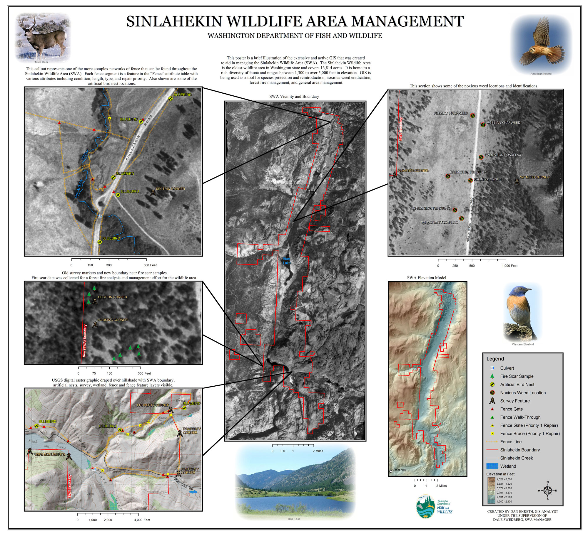
This poster is a sample of the extensive GIS that I built from scratch during my internship as GIS Analyst for the Department of Fish and Wildlife. Most of the GIS layers, databases, and attribute tables consist of data that I collected in the field via GPS and other instruments. The GIS that I created is an active and dynamic system that is being used for a greater management of the Sinlahekin Wildlife Area.
