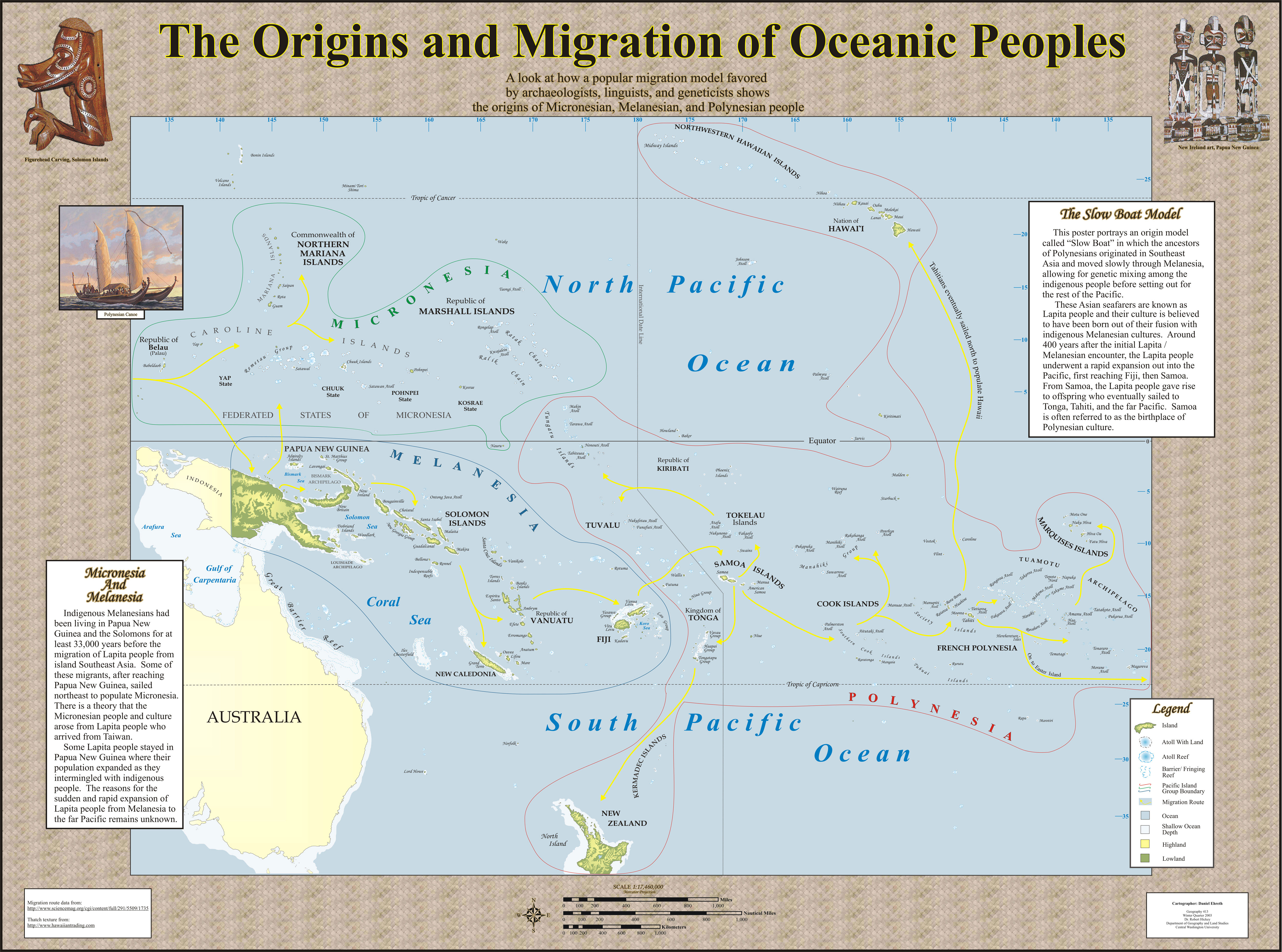
Please zoom to full extent to appreciate the detail of the cartography. I created this map from scratch using Corel Draw and ArcGIS. Besides detail, one of the more challenging aspects of creating this map was illustrating accurate topography that suggests 3-D. In an attempt to maintain geographic accuracy, all map objects were created by digitizing over a combination of GIS data and georectified maps of the Pacific that were originally in hardcopy form.
